The Hotel Rock Side Canyon is about 2.5 miles along the Arch Canyon Trail, west of Blanding in southeast Utah. The Arch Canyon trail head is 2.5 miles north along a dirt road from Highway 95 just west of the massive sandstone wedge of Comb Ridge.

The Arch Canyon Trail is a 4WD route that runs for 8 miles to two large arches, Cathedral Arch and Angel Arch. The canyon bottom has year round water and there are Ancestral Pueblo Ruins sites along the way. Near the beginning of the trail is the large Arch Canyon Ruins site, with several standing walls, rubble piles and petroglyphs. At about 1.5 miles, there is a small alcove site that is easy to visit.

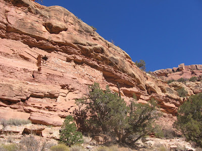
The ruins sites tend to be on the south facing side in most locations to catch the winter sun. My hike in early November was on a warm sunny day. I noticed that on the shady north facing side of the canyon, there were still patches of snow from an early season winter storm the previous week. Even though the temperature was very mild, without the sun the microclimate is chilly.

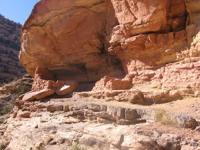
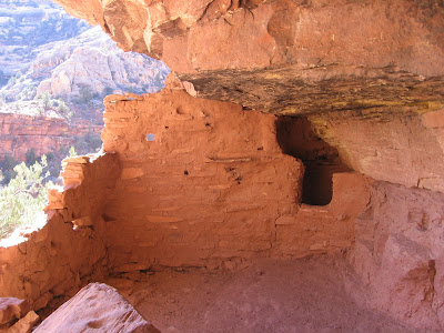
There is another good ruins site at about 2.5 miles, just before the canyon junction with the Hotel Rock side canyon. This site
blends into the canyon wall so well that it is easy to miss. The main hint is the side road from the 4WD trail that leads over below it.

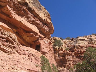
Just to the right of the main structure on the same level is a well preserved
storage ruin. I noticed the the door of the storage ruin before seeing the main structure. There are additional small wall fragments to the lower right of this upper level pair of ruins.

The Hotel Rock Trail starts at the same trail head as the Arch Canyon Trail and climbs along the north canyon rim to a large rock outcrop with small ruins in a side by side arrangement. Below the Hotel Rock, there is a view of the side canyon that makes a junction with Arch Canyon. I turned up the side canyon, searching for more ruins sites and whatever else might be interesting.
It didn’t look like many hikers or horseback riders come this way. The canyon bottom is walkable but I didn’t see any foot prints or any signs of a trail. The canyon bottom is narrow, without any room for farming fields and I didn’t see any permanent water. I hiked up the side canyon for about 1:00 hour, making about 1 mile and didn’t notice any ruins sites, and didn’t get far enough to get a view of Hotel Rock from below.
There weren’t any major obstacles and a hiker could go further than I did, but I didn’t find any good hiking destinations except for wild canyon scenery. My total time on this hike was 4:15 hours for about 7 miles. I carried 3 liters of water on a 60 F blue sky early November day.