Saturday, November 20, 2010

Mexican Hat Rock

Mexican Hat is a small town on the banks of the San Juan River about half way between Bluff, Utah and Monument Valley Tribal Park at the Arizona state line. About 3 miles north of town on Highway 163 is the Mexican Hat rock formation.

There is a highway sign for Mexican Hat Rock at a good gravel road that leads the short distance down the west side of the formation to a dirt turnoff with some parking space.

From the parking area there are some rough roads that provide a short easy hike up for a closer look. I stopped at the easy level, but climbing up higher is feasible and equipped rock climbers can get on top of the hat. The hat part is described as 60 feet across and 12 feet thick.

The Mexican Hat is visible from the San Juan River by the rafters floating past. There are also good views of the unusual tilted and eroded geological layers on the south side of the river.

Tuesday, November 2, 2010

John’s Canyon Rim Trail

John’s Canyon is tributary to the San Juan River downstream of the Goosenecks State Park in southeast Utah. The access is along County Road 244, a north turn off of Utah Route 316, the paved road that leads to the State Park. The access road passes below the Muley Point Lookout point on the southwest side of the Cedar Mesa area.


I drove 15 miles along County Road 244 to a flowing creek crossing and started hiking there. The road is drivable in a Subaru, but gets a little rougher the further you go. There is a metal gate to open and close after 7.0 miles. It took me about 1:00 hour to travel the 15 miles. I hiked west along the same road along the north rim of the inner canyon. It looks like a hiker could also hike down into the inner canyon or hike up canyon.

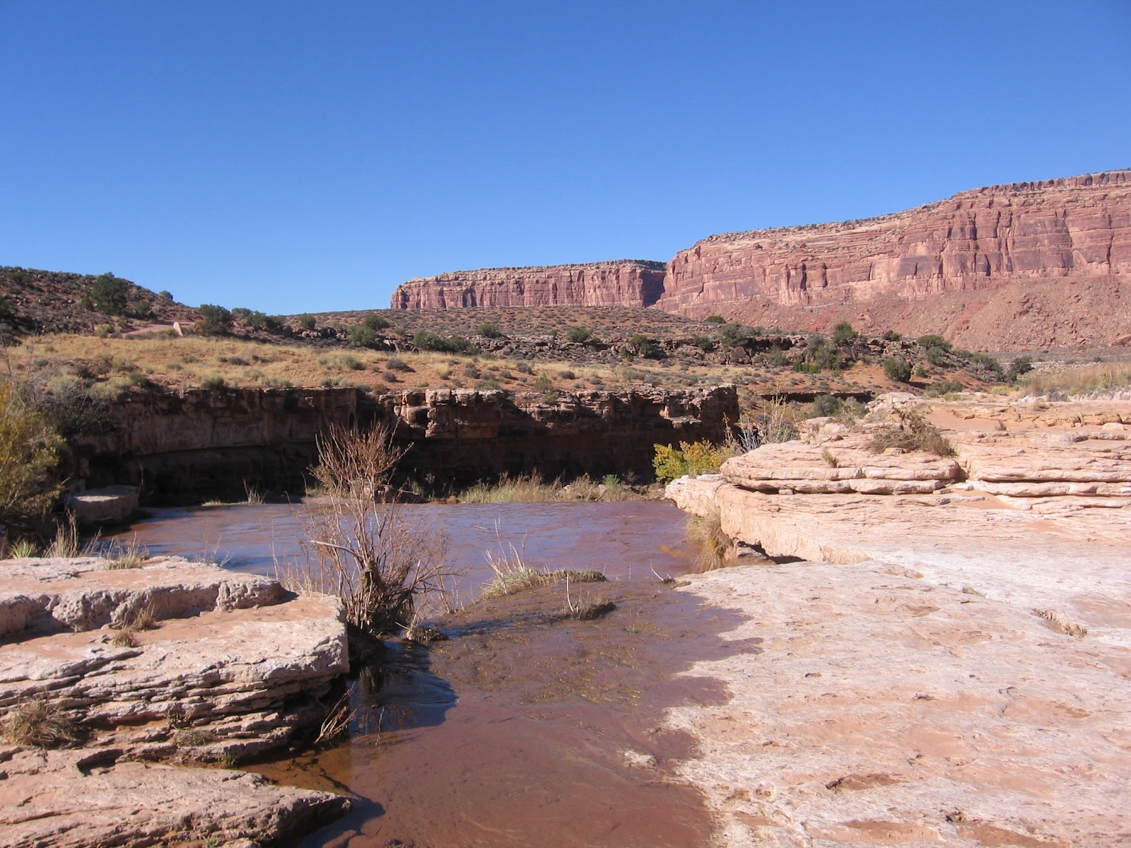
The attraction of the north rim is the several petroglyph panels along the way. John’s Canyon, in this area, has some massive sandstone cliffs sitting of softer eroded layers. The level area has Mormon Tea, another desert shrub that I think is Blackbrush, Prickly Pear cactus, a few scattered Juniper trees, and some desert grasses. There are cottonwood trees near the flowing creek.


After about 1:00 hour of hiking there is a boulder with some petroglyph figures on the south and west faces. The south face had some sheep figures and the west face had what I thought were lion tracks.


The second panel that I saw arrived after 1:25 hours of hiking. The trail makes a curvy descent and the upright boulder is where the route straightens out. This panel has an assortment of figures. I didn’t see any ruins near these panels, but there are some possible rock shelter areas among these boulders.


Ten minutes past this site, practically within sight, is another boulder with art work on at least two faces, the most on the west face.


 All of these boulders were close to and easy to spot from the trail.


These petroglyph sites are along the edge of the gradually deepening inner canyon. Down below there is some flowing water, but it doesn’t look like these is any easy access to the bottom. Directly across the canyon, the road into the area is visible.


I turned around after this third site. My return hike took 1:30 hours for a total hike of 3:40 hours for 7 or 8 miles. It was a 60 F degree early November day and I carried 3 liters of water. On the return drive I noticed another panel along the road a short distance west of the metal gate.


Tuesday, October 5, 2010

Mule Canyon North Fork Trail

The Mule Canyon North Fork Trail is a parallel route to the nearby and somewhat more popular South Fork Trail in Mule Canyon in the Cedar Mesa area of southeast Utah. The trail head for the North Fork is about 0.5 miles past the starting point of the South Fork Trail.

There is a small parking area just before a narrow wooden bridge. Both are north off of Scenic Byway, Route 95 west of Blanding and a short distance east of the roadside Mule Canyon Indian Ruins site. The Mule Canyon trails are among the canyon areas where BLM is charging a modest $2 per hiker permit fee.

The North Fork route mostly follows the creek bed with some trail segments around the spots where pools of water form. The canyon starts out shallow and gets deeper up canyon. This canyon environment includes tall Ponderosa Pines and a few Douglas Firs along with the Pinon Pines and Utah Junipers.

After about 20 or 30 minutes of walking, there is a small one room Ancestral Pueblo Ruin on the right under a rock overhang. This site appeared to be a place where someone could have lived, rather than a storage place for grain. The canyon isn't very deep at this point and the site isn't very high above the creek. The left wall seemed particularly thick for a one story structure.

This part of the canyon has Pinon Pine and Utah Juniper Trees. On a day or two after some rainfall, there were many small pools of water in the creek bottom. The canyons in this area appear to be very dry, but I was impressed with how much water could have been collected after a storm event occurs.

About thirty minutes later, 1:00 hour into my hike, a granary structure is visible under a sandstone overhang high overhead. Along this trail segment, there is also a lot of Manzanita, an evergreen shrub with leathery leaves. I also saw some of the silvery Roundleaf Buffaloberry that is common near Natural Bridges National Monument. Along the canyon wall, there is some obvious water seepage between the layers of rock with some hanging garden type plants taking advantage of the moisture.

Below the granary is another creek level structure hidden in a small alcove. The room on the left had the roof woodwork holding together well and I saw some spiral petroglyphs in the black stained stone on the left.

It looked like the roof work of a circular kiva was directly in front of the two rooms. This site seems to be an example of what other interpreted sites call a unit structure, rectangular rooms and a kiva combination.

Another high level series of structures in visible another 0:30 minutes further up the canyon. I climbed up a little to get a closer view. There seemed to be a central residence structure with a storage structure on each side.


I was interested to see some flowing water trickling down the sandstone a short distance past the skyline ruins. All along this segment there are signs of seeping water between layers of sandstone. I turned around about 0:15 minutes past the skyline at a point where boulders blocked the trail and a pool of water makes climbing past the boulders inconvenient.

My return hike took 1:45 minutes without any stops. My total hike took 4:00 hours on a 72 F degree early October day, and I only saw two other hikers. I carried and drank 3 liters of water.


Saturday, September 11, 2010

Whiskers Draw Trail

The Whiskers Draw area in the Manti-La Sal National Forest can be accessed by turning north on the well marked South Cottonwood forest road, 6.4 miles west of Blanding along Utah Route 95 in southeast Utah. After about 8.3 miles there is a forest road Y junction where I continued left for 2.6 miles to a vague jeep trail that heads south.

I started my hike at the jeep trail, which headed for a sandstone canyon rim and turned east. There are good views at the trail head area of the Abajo Mountains. The south facing canyon wall has many alcoves, some of them sheltering Ancestral Pueblo ruins sites.

Following the jeep road east was the wrong way to go for the relatively well known site I was looking for. The site I wanted to find is slightly west, near the head of a narrow side canyon, and is only visible from the long peninsula of rock that extends into the center of the canyon. Walking back west along the rim, there is a good view of the side canyon to explore.

After 2:00 hours of exploring the east end of this area, I arrived at the overlook of the double alcove site. It is feasible to get down closer to the site. There isn’t a marked trail that I could find, but walking further out along the rocky finger, there are trail segments through the forested sections, down to the canyon floor.

There are two smaller alcove sites about 300 yards down canyon from the double alcove site in the vicinity of the route down. Without any wandering, it should take less than an hour to get in position to visit these three sites.
The trail up to the double alcove site is along the creek bottom and the vegetation in this area is very thick. I think the thick vegetation here is mostly Hackberry trees and there were quite a few of them. Further down the canyon, there are Cottonwood trees and wide sagebrush fields.

The soil is very deep in the wider parts of the canyon, and there are deep eroded drainages. The mesa top areas and canyon sides has Pinon Pines and Utah Junipers. There is a trail segment that leads to the right side of the site.

There are several rooms and wall sections intact, lots of black soot on the sandstone walls, some timbers lying around. There isn’t a good view into the upper alcove from below.

The sites I visited had a variety of rock art, including a large red zig zag. There were also some red crescent figures that I thought were sheep and some red hand prints toward the left side of the site. I only visited one of the two small sites that were 300 yards down canyon. The small alcove I visited had two rooms and with several petroglyphs, including a human figure with a duck on its shoulders instead of a head, and a corn stalk figure.

I saw two more alcoves about 0.5 miles to the east of the double alcove site that had ruins in them, for a total of five in this area. This was the exploring I did first, before I found the site that I was actually looking for. At the end of the jeep trail there is a relatively gentle slope down and a vague trail up stream to an obvious large alcove on the west side a narrow side canyon.

Around the corner back downstream and west toward the main canyon, there is another large alcove with some rubble and minor wall fragments, and several examples of rock art, including some red side by side broad shouldered figures. This site also had some horse and cattle figures, and some of the artwork appeared to be done in black charcoal.

The hiking looked easier along the mesa top than down in the canyon bottom, due to the thick vegetation and very deep eroded washes, so I visited these two adjacent areas with separate fairly easy descents. My total hike in Whiskers Draw was 3:45 hours on a 74 F degree early September day. I carried 3 liters of water.


Tuesday, May 25, 2010

Lower Mule Canyon Trail

The Lower Mule Canyon Trail enters the mouth of Mule Canyon as it makes a junction with Comb Wash on the west side of Comb Ridge in southeast Utah. The starting point is the campground area that is along the south side of Utah Scenic Route 95 just below the engineered notch in the massive Navajo sandstone wedge of Comb Ridge.

The ATV trail turnoff into Mule Canyon is about 0.8 miles south of Highway 95. I started at the campground and enjoyed the views south along Comb Ridge. The main county road can be driven further than I did and crosses a creek before the turnoff.

From the turnoff the trail passes along the Mule Canyon creek bottom, through an area that is thick with Cottonwood trees.

The trail crosses the creek twice before arriving after about 0.3 miles at a marked foot trail that loops around the first side canyon on the north side.


There are three small Ancestral Pueblo ruins sites on the east side along the trail and another on the west side.


The first two ruins sites are small. The third site is the largest. I didn't climb up to look closer but there may be some interesting features to this site.


The fourth site on the west side might be the first one that a hiker would spot as it is visible across the side canyon. Approaching from below, the most obvious structure disappears behind the ledge. There are also two other small structures above and to the left. 

Continuing on up canyon, there is another side canyon on the north side almost immediately. I didn't see a trail going up the second side canyon, but there is a sandy hill at the mouth that allows a good view.


I didn't see any ruins sites up the second side canyon, but the sandy hill had many gray pottery shards and a few with black on white designs. I also saw two reddish hard stones that looked like small sharp tools. 

There may be source of reddish chert in the area, perhaps in the first north side canyon. Chert breaks in a way that forms very sharp edges and it is very hard, a 7 on the Mohs scale. It doesn’t have much use today but was an important tool making material.


Further west the horse trail dips into the creek bottom, but I followed a vague ATV track that stayed closer to the north canyon wall. In this area there were many spring desert wildflowers in bloom including Cliff Rose and this spectacular Miribilis in the Four O’clock family (swcoloradowildflowers.com is an excellent source for wildflowers). 

There were also Single Leaf Ash trees, Roundleaf Buffaloberries, and I saw one Ponderosa Pine mixed in with the Cottonwoods. The Lower Mule Canyon area has a few Tamarisk trees but they haven’t taken over as they do is some areas.


There is also a fifth ruins site near the point where Mule Canyon turns to the northwest. There is a double alcove with some wall sections still standing in both of the high alcoves. I continued further up canyon for another 0.5 miles. This next section of canyon appears to be dry and narrow, no water and no farming fields. Hiking much further, a hiker could approach the popular hiking areas that are at the upper end of Mule Canyon.

I turned around after 2:30 hours of hiking and it took me 1:25 hours to return to my starting point. My total hike took 4:10 hours for about 6 miles. It was a relatively cool 55 F degree late May day that started with some light rain that cleared quickly.