Tuesday, October 18, 2011

Road Canyon South Rim

The south rim of upper Road Canyon can be accessed along the Cigarette Springs Road. This bumpy road is one of the east turnoff, about 10 miles south of the Kane Gulch Ranger Station along Utah Route 261 in the Cedar Mesa area of southeast Utah.

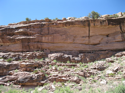
About 6 miles east there is a north turnoff that leads about 0.8 miles to the Road Canyon south rim. At the rim there is a route that descends into the canyon and a trail both east and west along the rim. I followed the rim trail east. Road Canyon is deep and layered as it meanders toward the east. With binoculars, there may be small Ancestral Pueblo ruins sites visible across the canyon.

The trail is easy to follow along the dirt segments and has rock cairns marking the way on the bare sandstone segments. After about 2 miles, there is a peninsula extending out into the twisting canyon. Just before the peninsula, there is a rocky outcrop with several large potholes that were holding pools of water.

The trail descends, with some rock scrambling, about 30 feet on the west side to a ledge and then crosses above the neck of the peninsula. There is more scrambling with a looping descent down the sloping sandstone before reaching the level of the narrow neck that leads to the large outcrop at the tip. This segment is somewhat exposed but is marked with cairns.

On the south side of the large boulder formation at several well preserved rooms. Sometimes these large boulder based sites have rooms on the boulder top, but there is no sign of that here. I didn’t see any kivas or rubble pile structures in the level area below these rooms. This doesn’t appear to be a village. Not very many people could live here and it looks like there isn’t much winter shelter.


These rooms don’t have a view toward the approach along the peninsula. One room has a good view down the canyon. 

Sleeping Ute Mountain, Mesa Verde, and the LaPlata Mountains are visible in the far distance, about 100 miles away.

One of the rooms has what appears to be a small window. Many of these structures have small openings in addition to the doorways, but an intermediate size opening like this seems unusual. There was a small display of artifacts here.
There are two low walls along the walkway out to the rocky peninsula. If these were for defense, they don’t seem to be much of a barrier compared to the rocky ledges that come before. My total hike took 4:00 hours on a 64 F windy mid October day. I carried and drank 3 liters of water. I saw 4 other hikers and 4 dogs during my hike.

532497_120 x 90 Starting Salary $42k. Group 1
528614_Russell Outdoor Logo 125x125 18407_$5 Shipping on Orders of $99 or More!

Wednesday, October 12, 2011

Lower Snow Flats Road and Mormon Trail

The lower end of the Snow Flats Road begins about 2 miles north of the south end of the Comb Wash Road. The south end of the Comb Wash Road is a north turn off of Highway 163 about 8 miles west of Bluff in southeast Utah.

There is a junction where the Snow Flats Road splits from the Comb Wash Road with Snow Flats branching off to the left. It is marked as County Road 237 and there are also the covered wagon symbols of the Mormon Trail. About 3 miles past this junction, there is an information kiosk.

This route has some bumpy eroded spots where it crosses the small washes. There is a sign reminding visitors that a special permit is now required to visit the Moon House ruins site. I think that from where I started hiking, it is at least 10 miles to Moon House. Hiking in this area has good views of the west side of Comb Ridge and is historic.


I started hiking at the information kiosk that is 5 miles north of the junction with Highway 163. The Snow Flats Road turns northwest and starts to climb. The vegetation close to the Comb Wash is mostly Greasewood and Three Winged Saltbush. As the road climbs, the vegetation changes to Blackbrush and Mormon Tea with Cliff Rose, Narrowleaf Yucca, Indian Rice Grass and a few Utah Junipers.


About 2 miles past the information kiosk, there is a short side road that leads to a south overlook over the lower part of Road Canyon. There was a trail leading down from the overlook and it looked like this was a route to the canyon floor.

I followed the trail down a short distance, but on this hike I wanted to explore along the road. I spent about 30 minutes looking around this rim area but didn’t notice any Ancestral Pueblo ruins sites. Continuing on, there is an entrance sign for the Road Canyon Wilderness Sturdy Area.


After 2:20 hours of hiking and about 4 miles, I stopped and climbed a low hilltop that had good 360 degree views. It looked like there is a survey monument on top of this hill. The Snow Flats Road continues across a level area for about 1.5 miles before reaching the distant cliffs. The road on the section I hiked was in good condition.

The return hike shows the views of the massive barrier that the Mormon pioneers faced as they descended off of Cedar Mesa. In 1879-1880, 200 people with 83 wagons, several hundred horses and 1000 cattle descended this way. There aren’t any interpretive signs along this section of trail. On the rough road that continues south of Highway 163 there are several signs pointing out the places where the pioneers were eventually able to cross Comb Ridge. In Bluff, the Fort Bluff site has been developed into an interesting historical site.


When viewing Comb Ridge from the east side, the pinkish Navajo Sandstone is mostly visible. From the west side, this appears to be the cliffs of the Wingate Sandstone sitting on the shales and mudstones of the Chinle layer. The ledgy Kayenta layer above the Wingate seems to be present most of the way with a few glimpses of the Navajo sandstone. This section of Comb Ridge just east of the Snow Flats Road, where the Navajo sandstone is visible, is the area where the Procession Panel is located.


My total hike took 4:00 hours for 8 or 9 miles. I carried and drank 3 liters of water on a 65 F degree mid October day. I didn’t see any vehicles on the Snow Flats road during my hike. There was one vehicle that appeared to be camping.


 528614_Cool Camo Russell Outdoors

Wednesday, September 21, 2011

Arch Canyon to Comb Ridge Trail

The trailhead area for the Arch Canyon trail is 2.5 miles north along the BLM road that is just west of Comb Ridge along Utah Scenic Route 95. This area is west of Blanding in southeast Utah.

I started my hike over Comb Ridge from the Arch Canyon parking area and followed the BLM road north, crossing the mud hole formed by the Arch Canyon Creek.

In the first five minutes back on the road north, there is a hilltop rubble pile ruins site visible. Not much has held together at this site, but there are good views up the Comb Wash and back toward the mouth of Arch Canyon.

It appears that the mouth of Arch Canyon has three ruins sites that guard the approach. Walnut Knob and this hilltop site provide elevated lookout points and the large rubble pile below directly guards the entrance.

It took 1:10 hours to climb to near the top of Comb Ridge. This trail is the old road that was in use before the engineered notch that Highway 95 uses. The road is very rough but probably usable by ATVs. I didn’t see any vehicles on the trail while I hiked, though there were vehicles on the better roads at the top. At the point where the trail crosses the head of a short side canyon there are pictographs and petroglyphs to find.


The pictographs are in a sheltered alcove above some steep cliffs. There are many hand prints and other figures, including a white star and a reddish human figure with large hands and feet. From this angle there isn’t a way to climb up closer.

From the same view point for the pictographs a jug handle type arch is visible. The arch is directly above the trail and is visible from only a narrow angle.

A short distance past the pictograph is a petroglyph panel. There is a trail that allows a close view. The side trail starts about 150 yards further up the main trail and comes back along a ledge. The side trail isn’t marked but is clearly visible.
Flute player images are fun to find. This one doesn’t seem to have a backpack or any headgear.

At the top of the trail there is a side road with a San Juan County marker. Some maps show this road as Posey’s Trail. I continued past this road to a faint ATV trail and turned south. Along this ATV trail I could see the alcove that contains the Tower House Ancestral Pueblo ruins site. I found a way down into the Butler Wash and continued to the ruin along the wash, but this isn’t the common way to arrive there.

There is a second faint ATV trail about 0.2 miles further east that also leads south and has a rock cairn marked trail that continues. There aren’t any signs for the trail along the road. It took me 2:25 hours to arrive at the Tower House site. I hiked on a mid September day that was 60 F at 9:30 AM and 82 F at my 2:15 PM finish. I carried and drank 3 liters of water.


Tuesday, September 20, 2011

Tower House Ruins Trail

The Tower House Ruins Trail starts as an unmarked vague ATV trail and then is marked with rock cairns down into the head of Butler Wash in southeast Utah. I arrived by hiking up the west side of Comb Ridge from the Arch Canyon trailhead parking area. You could also drive to the trailhead by driving on forest roads from the east. (Find the post on Posey's Trail for information on the roads to this area.)

The tall tower to the left is the most eye catching structure along with the smaller structure to the right.

The building style of the lower level seems to use flatter stones with more mud mortar than many of these sites. The upper level seems to use larger stones. One could guess that the upper level was built at a later time or by different builders.

Between the two structures are a several examples of rock art. The human figure to the left with large hands is somewhat similar to a large hands and feet pictograph I saw while hiking up from the west side.

The alcove continues to the right of the main structures. Down in the shady area there is a circular structure sunk into the alcove floor.

Some of the brickwork of the kiva is still in place. On the alcove wall between the two sections of alcove there are more rock art examples and several places that were used to shape and sharpen stone tools. The eye catching rock art includes some red hand prints.

In the area in front of the alcoves there are some Cholla cacti that provide some color. The area about 200 yards downstream from the alcove has a couple of Ponderosa Pine trees growing at the bottom of the wash.

Cottonwood trees also grow close to the wash bottom in an area that otherwise has Pinon Pines and Utah Junipers. There are more alcoves in the area, but I didn’t see any other structures. I spent about 0:25 minutes at the ruins site and it took 0:20 minutes to climb back up to the road.


Sunday, June 12, 2011

Three Kiva Pueblo Neighbors

The Three Kiva Pueblo is an accessible Ancestral Pueblo ruins site in the Montezuma Canyon in southeast Utah. Much of the floor of Montezuma Canyon is private property but there are several small ruins sites that can be viewed from the road.

 Three Kiva Pueblo is about 27.7 miles south from the north end of Montezuma Canyon Road. High on the cliffs to the east of Three Kiva a small storage structure is visible with binoculars under an overhanging rock. (It is in this picture but is hard to see.)

 A small granary site is about 0.8 miles north. There is a side road leading to the area below the structure.


The largest site that I saw was 2.9 miles north. There are several cliff structures in a wide alcove with some rubble structures below. 

This site has a protective fence in front. This site also has a loop side road leading to the site.
 

The northern area of the Montezuma Canyon has many alcoves. Most are hard to see from the road but there is one where some wall fragments are clear. This site is about 13.4 miles north of the Three Kiva site. Traveling slowly along the 35 miles of Montezuma Canyon and stopping when I though I saw something took about 3 hours. There are more sites than I mention here and probably more that I missed.


Thursday, June 9, 2011

Montezuma Canyon Rock Art

Three Kiva Pueblo is a publicized Ancestral Pueblo site along the rugged Montezuma Creek Road between Monticello and Blanding in southeast Utah. The north end of Montezuma Creek Road, C-146, is five miles south of the Visitor Info Center in Monticello, Utah east off of Route 191.


About 6.8 miles south of the Three Kiva Pueblo, there are cliffs close to the road with several petroglyph panels. There isn’t a sign but there is a turnoff parking spot on the west side of the road. The panels extend for several hundred feet.
 
It is a short climb up to the base of the cliffs and there is a primitive trail to follow. Some of the figures must be relatively recent and include riders on horses.


The figure in the upper left seems unusual. The bottom part resembles a flute player, but the part on top is more elaborate than the usual flute player head dress.
 
Some of the figures appear much older and ghostly in appearance. To the right, it looks like the larger figure is standing on the shoulders of the smaller figures.


The bird images are particularly clear. They look like herons or some shorebird. There is water in the Montezuma Canyon but I didn’t see any wetlands that would provide habitat for this type of bird.


Wednesday, June 8, 2011

Wagon Wheel Trail-Blue Mountains

The Wagon Wheel Trail visits the east side of the Blue Mountains in the Manti-La Sal National Forest in southeast Utah. The trail head is 5.4 miles along the forest road past the Devils Canyon campground. The campground is between Monticello and Blanding, Utah on the west side of Highway 191.

At the trail head area there is a primitive campground area with a restroom. The trail head for the Camp Jackson Trail is 0.4 miles further along the forest road. In this area, there is a network of ATV trails and many of the side forest roads have trail markers.

Besides being numbered as trail 168, the Wagon Wheel Trail appears to have an ATV Route 90 designation. The trail head elevation is about 8200 feet and the trail climbs about 800 feet in 2 miles.
 
The route passes through Ponderosa Pines and Gambel Oaks with Aspens appearing as the trail climbs. There are views of South Peak at 11, 419 feet, and a cliff layer that the peak rests on. After about 0:25 minutes of hiking there is a trail junction. The main route is marked to the right, continuing north. I detoured to the left and followed the side trail climbing another 0:20 minutes until it dead ended at a canyon rim.
 
I thought the side trail was more scenic than the main trail with views to the west toward the Bears Ears and the canyon country of Cedar Mesa. There were also good views back to the east toward Sleeping Ute Mountain and the LaPlata Mountains. The Camp Jackson Trail may descend down into this canyon area.
 
Back on the main trail, there are views of South Peak all along the way. In early June, there were several moist meadows along the way with Iris in bloom.
 
The route continues north, and crosses Verdure Creek and North Fork Creek, each with a small bridge. The first creek had many maple trees in the moist drainage. There is another trail junction between the creeks and I stayed to the right following the marker for ATV Route 90.

I turned around about 0:15 minutes past the trail junction, about 2.5 miles from the trail head. My return hike took 1:00 hour. My total hike including the side trail took 3:30 hours for about 7 miles. I carried and drank 2 liters of water on a 62 F degree early June day.
 
 At the Devils Canyon Campground, there is a short 0.2 mile interpretive trail that is themed “The Forest and Man.” There is a trail guide and 12 stops that discuss the forest trees and signs of forest fires and forest use by man.

At stop 12 a small Ancestral Pueblo storage ruin is visible across Devils Canyon. Devils Canyon runs 13 miles southeast and joins Montezuma Canyon where there are also many ruins sites.


528614_Russell Outdoor Logo 125x125