Showing posts with label Blue Mountains. Show all posts

Tuesday, October 16, 2012

Dry Wash Trail-Blue Mountains


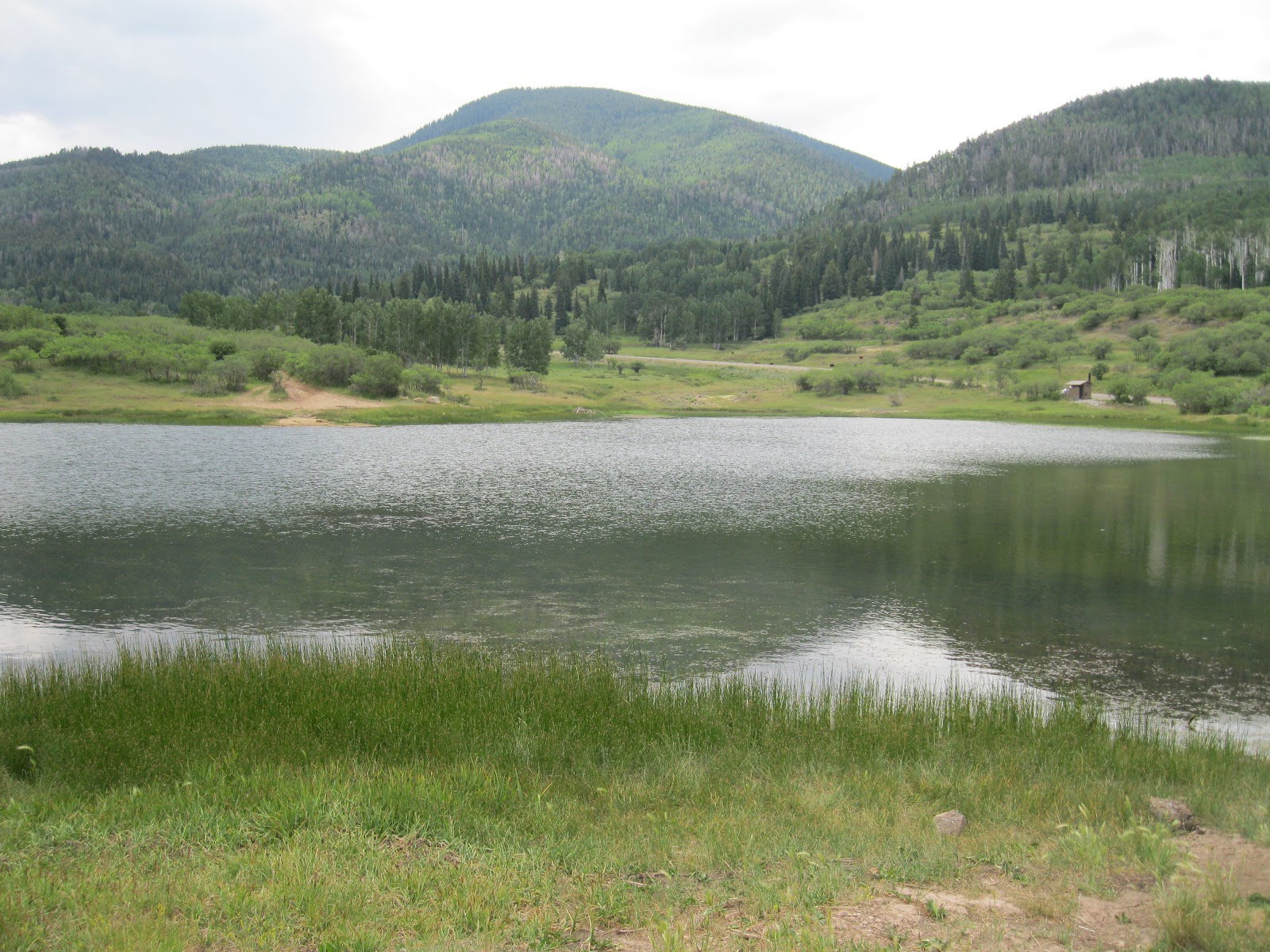
The Dry Wash Trail is labeled as Road 5385 where it makes a junction with Forest Road 095 about 1.3 miles west of the Nizhoni Campground area in the Manti-La Sal National Forest. This area is reached from the Dry Wash Forest Access Road on the north side of Blanding in southeast Utah


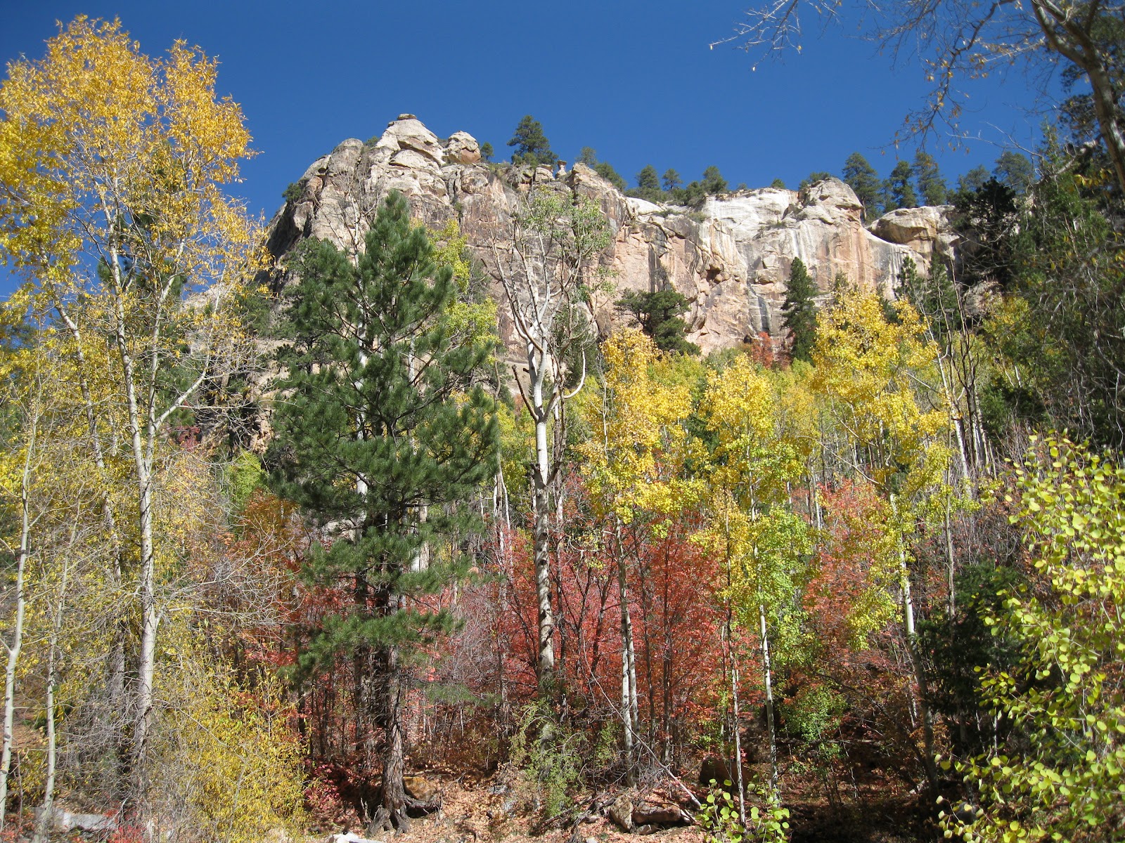
The trail travels north along a rough forest road. In the distance there are some alcoves visible in the sandstone cliffs. I thought there might be ruins sites in this area, but I didn't know where they might be.


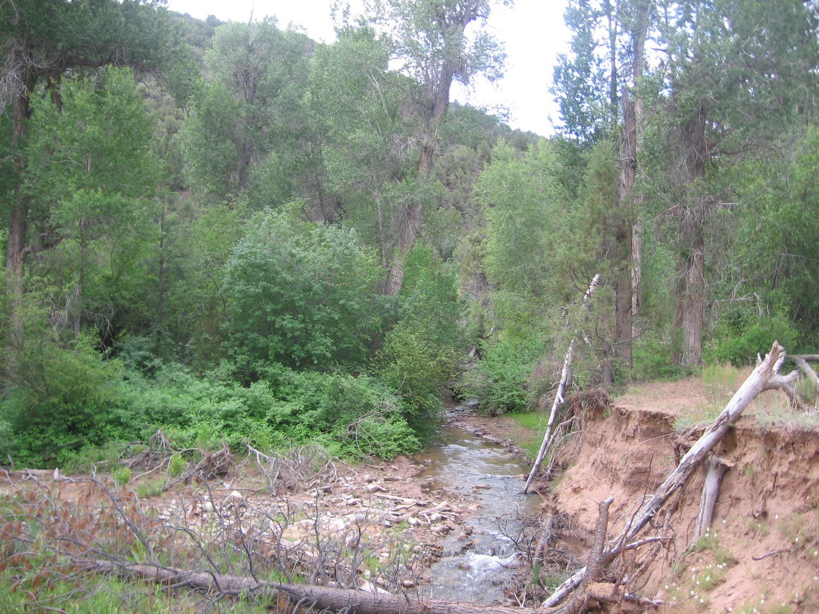
As the trail climbs, the alcoves are obscured by the rich forest and go out of sight and it is easy to walk past them. I stayed on what appeared to be the main trail for about 1.5 miles and then followed a cow trail for about 0.5 miles further, checking the sunlit side canyons for signs of ruins. The forest here is a mix of Ponderosa Pines and Douglas Firs, Aspens, Maples, Narrowleaf Cottonwoods and Gambel Oak.


On the return hike, after not seeing any ruins, I walked up an east leading side trail that is less than 10 minutes from the starting point that appeared to head for the alcoves that are visible. This trail climbs and passes below the alcoves and then arrives at a T junction of trails. Staying to the left there is a bench and interpretive sign. There aren't any trail markers to guide you to this spot, but if you arrive there is a place to sit and enjoy the view.


Up above is the Dry Wash Cave Ruins. The interpretive sign says that this is a food storage site, built in about 1250 AD. To the right, there is some intact stonework built around a frame of wood. To the left there is only a minor amount of stone remaining but many wooden poles that have fallen into a tangle. The interpretive sign says that this site was reached with the help of ladders and that visitors should not attempt to climb up.


The trail head elevation is about 7400 feet and the ruins sites are at about 8000 feet. The interpretive sign says that the Ancestral Pueblo People came this high into the mountains for the water supply, just as we do today. Past the ruins view area there is a pipe visible that is conducting water to the town of Blanding.


Returning to the T junction and continuing around the canyon shelf, there is another view point about 0.2 miles away that shows two more storage sites visible.


In the smaller site the stone work appears to be well preserved.


I followed this trail for another 0:10 minutes where there are views that include Mt. Linnaeus, the alcoves, and the canyon area north of the alcoves. From this point it took 0:30 minutes to return to the trail head. My total hike took 3:30 hours including 2:00 hours of being off the direct track to the ruins sites. I carried 2 liters of water on a 60 F degree mid October day. There were no other hikers in the area on the day I hiked.


Wednesday, October 10, 2012

Skyline Trail Loop-Blue Mountains


The Skyline Trail is in the Blue or Abajo Mountains in the Manti-La Sal National Forest in southeast Utah. The Dry Wash forest access road leads north from Highway 191 on the north side Blanding 11.6 miles to a forest road junction near the Nizhoni Campground. Forest Road 095 on the left leads west 5.8 miles to a trail that is marked No. 013.


A short distance up Trail 013 is marked as the Blue Creek-Allen Canyon Trail and it is noted that it is 2.3 miles to the Skyline Trail. The trailhead elevation is about 8500 feet and the climb to the junction with the Skyline Trail is about 1340 feet up to about 9840 feet. This trail is open to hikers and horse riders.


On the way up there are good views of Mt. Linnaeus at 10,958 feet. The trail is gravelly most of the way and climbs steadily. The lower segment of trail is mostly Gambel Oaks with scattered Ponderosa Pines.


The views to the south overlook the upper end of the Allen Canyon area. The road leading to the trailhead also has views of this canyon area. The Bears Ears are visible in the distance.


It took me 1:30 hours to reach the junction with the Skyline Trail. There aren't any trail markers at the top but the junction is clear. The Skyline Trail is 5.1 miles long and this junction is near the middle. In addition to the views of Mt. Linnaeus and Allen Canyon, there are skyline views into Tuerto Canyon.


I turned left to descend back toward Forest Road 095. Between the Blue Mountain peaks to the north, the La Sal Mountains are faintly visible in the distance. At this high elevation Spruce and Fir trees replace the Ponderosa Pines.


The descent from the skyline is about 2.3 miles and much of the way passes through Aspen forest. As the trail nears the forest road the Gambel Oaks come back and there are also Maples and a few patches of the evergreen Manzanita.


It took me a total of 3:05 hours to arrive back at the Forest Road 095, leaving a 3 mile walk back to my starting point to complete the loop. This trailhead for the Skyline Trail is well marked and the same hike in the opposite direction could start here. There are good views to the south all along the road. A large alcove is visible that may have an arch on the right side.


About 1.3 miles west of the Skyline trailhead is a view point called the Causeway. I saw more than 10 deer on this trip and two groups of turkeys. My total hike took 4:20 hours for about 7.6 miles. I carried and drank 3 liters of water on a 65 F degree mid October day.


528614_Russell Outdoor Logo 125x125

Tuesday, July 3, 2012

Harts Draw Scenic Route-Blue Mountains


The Harts Draw Scenic Route travels west from Monticello, Utah up along the north side of the Blue or Abajo Mountains in southeast Utah. It passes several campgrounds and small lakes before turning north and descending to intersect Utah Route 211, the route to the Needles District of Canyonlands National Park.

The total route distance is about 20 miles. The west turn from Highway 191 is at the Monticello Visitor Information Center.


At a high point before the north turn, there is a lookout point with two interpretive signs and sighting tubes pointing out some of the Canyonlands features that are visible in the distance.


One of the sighting tubes points to the Shay Mountains. One of the interpretive signs describes Mountain Building. Magma bulged up under the sandstone surface 27.9 to 25 million years ago. The overlying sandstone has mostly eroded away leaving the igneous rock to form the peaks.


About 2 miles east of the lookout point is the small Monticello Lake. It is possible to walk all the way around this small lake and get views of the north side of the Blue Mountains. North, behind the lake there is a deep canyon with sandstone bluffs on the west side.


I tried a hike along the road marked as Forest Road 105 that makes a junction with the Harts Draw Road at Monticello Lake. This road travels north and passes through foothills vegetation of sagebrush, Pinon Pines, Juniper, Gambel Oak and Serviceberry, with a few Ponderosa Pines. In the distance the mountain hillsides with Aspens, Spruce and Fir are visible.


In the distance to the north, some of the Canyonlands area formations would be visible if it were a clear day. There are several side roads along the main forest road. Some of them are marked as ATV routes.


I walked about 2 miles north on the forest roads and returned to Monticello Lake. My total hike was for 2:45 hours for about 5 miles. 


Groups of wild turkeys are frequently sighted along this scenic route. It was a 75 F degree early July day. I carried and drank 3 liters of water. In early July 2012, Forest Road 79 that leads to the Red Ledges Trail area was closed during the week for roadwork.


Wednesday, June 8, 2011

Wagon Wheel Trail-Blue Mountains

The Wagon Wheel Trail visits the east side of the Blue Mountains in the Manti-La Sal National Forest in southeast Utah. The trail head is 5.4 miles along the forest road past the Devils Canyon campground. The campground is between Monticello and Blanding, Utah on the west side of Highway 191.

At the trail head area there is a primitive campground area with a restroom. The trail head for the Camp Jackson Trail is 0.4 miles further along the forest road. In this area, there is a network of ATV trails and many of the side forest roads have trail markers.

Besides being numbered as trail 168, the Wagon Wheel Trail appears to have an ATV Route 90 designation. The trail head elevation is about 8200 feet and the trail climbs about 800 feet in 2 miles.
 
The route passes through Ponderosa Pines and Gambel Oaks with Aspens appearing as the trail climbs. There are views of South Peak at 11, 419 feet, and a cliff layer that the peak rests on. After about 0:25 minutes of hiking there is a trail junction. The main route is marked to the right, continuing north. I detoured to the left and followed the side trail climbing another 0:20 minutes until it dead ended at a canyon rim.
 
I thought the side trail was more scenic than the main trail with views to the west toward the Bears Ears and the canyon country of Cedar Mesa. There were also good views back to the east toward Sleeping Ute Mountain and the LaPlata Mountains. The Camp Jackson Trail may descend down into this canyon area.
 
Back on the main trail, there are views of South Peak all along the way. In early June, there were several moist meadows along the way with Iris in bloom.
 
The route continues north, and crosses Verdure Creek and North Fork Creek, each with a small bridge. The first creek had many maple trees in the moist drainage. There is another trail junction between the creeks and I stayed to the right following the marker for ATV Route 90.

I turned around about 0:15 minutes past the trail junction, about 2.5 miles from the trail head. My return hike took 1:00 hour. My total hike including the side trail took 3:30 hours for about 7 miles. I carried and drank 2 liters of water on a 62 F degree early June day.
 
 At the Devils Canyon Campground, there is a short 0.2 mile interpretive trail that is themed “The Forest and Man.” There is a trail guide and 12 stops that discuss the forest trees and signs of forest fires and forest use by man.

At stop 12 a small Ancestral Pueblo storage ruin is visible across Devils Canyon. Devils Canyon runs 13 miles southeast and joins Montezuma Canyon where there are also many ruins sites.


528614_Russell Outdoor Logo 125x125

Friday, July 18, 2008

Indian Creek Trail-Blue Mountains

The Indian Creek Trail is on north side of the Blue or Abajo Mountains west of Monticello in southeast Utah. This is the same Indian Creek that flows past Newspaper Rock on the way to the Needles District of Canyonlands National Park.

The trail head is marked 021 and is located about two miles past Foy Lake down a narrow steep dirt road. The road to the trail head would make a good hike in itself with good views down the deep Indian Creek Canyon.
 
 The first part of the trail descends steeply down toward the Indian Creek and then the trail descends gently, passing through mostly lush riparian habitat. The Indian Creek was still flowing well in midsummer. The Pinon Pine and Utah Juniper at the trail head changed quickly to narrow-leaf cottonwoods and willows, with some box elder and birch.

In some places there were stands of Ponderosa Pines and a few Douglas Firs. In the moist areas Rocky Mountain Red Cedar replaced the Utah Juniper. Some of the Ponderosas were the old yellow barks that aren't seen very often. The sandstone cliffs that were visible from the trail are only the inner canyon. Views from higher up show this to be a very deep canyon.
 
 This appeared to be a little used trail. There were no footprints from other hikers here in midsummer. The only other users appeared to be cattle. I walked down the trail for 1:30 and came back up in about the same for a total hike of 3:00 hours.

Friday, July 11, 2008

Robertson Pasture Trail-Blue Mountains

The Robertson Pasture Trail is in the Blue or Abajo Mountains west of Monticello in southeast Utah. This small mountain range is one of several in the region that was formed as an igneous intrusion, molten rock pushing up and folding the overlying rock but not forming a volcano.


I started my hike at Foy Lake which is about 11 miles straight west of Monticello. There are several other trail heads in the vicinity of this small lake.

The trail starts in rich Pinon Pine and Juniper forest with  Gambel Oak mixed in. The route circles counter clock wise around North Peak at 10, 823 feet, and climbs fairly steeply.

Wildflowers are good along this trail. The lower part of the trail has good views to the north toward the Canyonlands National Park area. An area of petrified sand dunes is visible.

As the trail swings around the south side of North Peak the views to the west open up. The area to the west is the Dark Canyon Wilderness and Primitive Areas.

Arriving at the open meadow pasture areas there are views of Abajo Peak, at 11,014 feet the tallest point in this range. The Robertson Pasture Trail continues on and connects with other trails. I stopped after 2:15 hours at the point that seemed to be the crest of the Pasture area and returned to Foy Lake, going down in 1:15 hours, for a total hike of 3:30 hours.