Friday, May 6, 2011

Upper Butler Wash Trail to Target Ruin

The Upper Butler Wash Trail is 1.25 mile route that visits three easily visible Ancestral Pueblo sites along the main trail. The trail begins 0.25 miles east of the well marked publisized Butler Wash Ruins Trail that is along Scenic Byway Utah Route 95 west of Blanding in southeast Utah.

Just inside the fence at the trail head for the Butler Wash Ruins Trail, there is a path leading to the right that follows near the fence to the Upper Butler Wash trail head. There is also parking space along the highway close to the trail head, but there isn’t a sign identifying the trail.

From the west rim, the Upper Butler Wash is a narrow green gash in the sandstone. Down below, the trail area has a meandering creek and many trees.

The Ballroom Cave site is visible in a large alcove about 40 minutes of hiking along the trail, and two more sites are a short distance further. Not visible from the trail, and easily missed is the alcove containing the interesting Target Ruins.

The side trail that I used leading to the Target site is about 800 feet back toward the trail head from the large Ballroom site. The trail climbs abruptly and is more visible on the return hike than on the outward trip to the Ballroom. Coming around a corner, there is an alcove visible on the left, but the right side view of the alcove with the Target ruins is startling.


The Target Ruins is well located to be seen, but not touched. It is one of the most attractive sites that is easy to get to in the Cedar Mesa area. The left side alcove that is visible first provides a place to climb up and get some different viewing angles. I’ve seen pictures that show a target pictograph inside the Target ruins, visible from high on the left side, but I couldn’t see it during my visit.
 
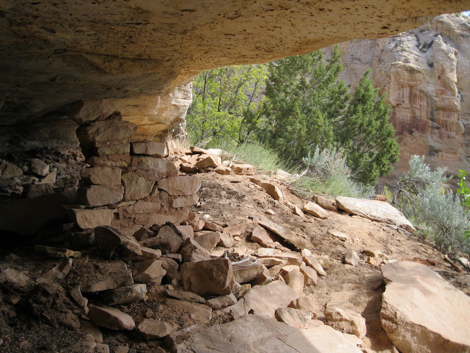
The left side alcove has a small structure that appears to be for storage. There is also a small target shaped petroglyph on the alcove wall. There also appeared to be another storage ruin in a smaller alcove to the left of the large left side alcove.
 
There is some minor rock art below the Target Ruins. I saw two turkey tracks and some white handprints. Below the handprints are some hard to see geometric designs that resemble the designs seen on pottery.

Between the Target Ruin and the Ballroom Cave, there is another vague and steep side trail leading to a small alcove. There is a small wall fragment in this alcove also. I climbed up here first, thinking this was going to be the Target Ruins site. The Upper Butler Wash Trail thus has five ruins sites to find. I spent 2:30 hours on this hike on a 65 F degree early May day.


532497_120 x 90 Starting Salary $42k. Group 1

18407_$5 Shipping on Orders of $99 or More!

Wednesday, May 4, 2011

Arch Canyon Walnut Knob

The trailhead area for the Arch Canyon Trail is 2.5 miles north along the BLM road that is just west of Comb Ridge along Utah Scenic Route 95. This area is west of Blanding in southeast Utah. Walnut Knob is visible from the parking area high to the south. There isn’t a marked trail but the sandstone slope is walkable all the way up.


The Arch Canyon Trail leads 8 miles to two large arches, Cathedral and Angel. There are also several Ancestral Pueblo ruins sites to find, including the large Arch Canyons ruins that are only a short walk down the trail. This trailhead is also a starting point for a hike to Hotel Rock along the north rim of Arch Canyon.
 
Walnut Knob is known as a petroglyph site, but there is some rubble on the top of the large boulder and around the sides, making it look like a ruins site also. Boulder based ruin sites like this are common in the Canyons of the Ancients area in southwest Colorado.
 
There are three panels to view. The most eye catching shows what appears to be a large shield with an array of mountain sheep, horses with riders, and some feet prints. I arrived in mid afternoon as the sun was sweeping across the figures.
 
From this elevated position there are good views, particularly toward the north end of Comb Ridge. To the lower left of the shield figure, there is an interesting horned humanoid figure. There is a spiral in the lower left The Walnut Knob climb is about 200 feet above the canyon floor area. From above, it looks like a road goes past, but the access is confusing due to the Ute Land, No Trespassing signs along the BLM road.
 
The panel to the right of the main panel also appears to show a shield with several animal figures. The third panel to the left has a few good figures but also has some modern graffiti.
 
On the return hike I noticed a fairly large rubble pile ruins site that overlooks the creek at the beginning of the Arch Canyon Trail. Every hiker and driver heading up Arch Canyon walks directly below this site. The location is interesting as it has a direct line of site with the Walnut Knob site and is only a few minutes walk from the large Arch Canyon ruins site.

There is one spot where some of the wall structure is still visible. The overall shape appears to be circular, possibly a large diameter tower.
 
It is possible to find a view point where the rubble pile ruins, the Walnut Knob, and the Arch Canyon creek are in the same view. My hike to the Walnut Knob took 1:10 hours on a 68 F degree early May afternoon.


528614_Cool Camo Russell Outdoors