Posey’s Trail is the maintained county road on top of the north section of Comb Ridge, west of Blanding in southeast Utah. From Blanding, heading west on Utah 95, turn north on the well marked Cottonwood Forest Road, and after 0.9 miles turn west.
The Posey’s Trail is marked as Road 240, and is 4.7 miles after the west turn. The unmarked trailhead for the Tower Ruin Trail is about 0.5 miles back east from Posey’s Trail.

After about 0:40 minutes of slow hiking the road passes very close to the west edge of Comb Ridge and there are spectacular views up and down Comb Wash. In mid May, there were many wildflowers in bloom in this area.
The road visible below leads from the Arch Canyon trailhead area and it is possible to hike to Posey’s Trail from there. The road that climbs up is too rough for most vehicles. Besides the views, there is some rock art and an arch along that route.

Visible to the west, sticking up from the mesa top area is Hotel Rock, a ruins site. There is a rough 4WD road leading there and it is feasible to hike there. I scanned the side canyons below with binoculars but didn't notice any other ruins sites.

Arch Canyon is the major feature below. Walnut Knob is visible but is hard to pick out.

After about 1:15 hours of hiking, about 2.5 miles, I came to an unexpected trail junction. The main trail continues south, maybe two more miles. The minor side trail leads east across the upper part of the west side canyon off of Butler Wash. On the other side, the trail then turns south. It looks like ATVs use this route and maybe horse riders.

Continuing south, there are a series of large alcoves across the canyon. I scanned this first group, and there might be some wall fragments visible. There are trails visible on the canyon bottom and along some of the ledges that lead to the alcoves. From where I was viewing, it was too steep to descend and approach these alcoves.
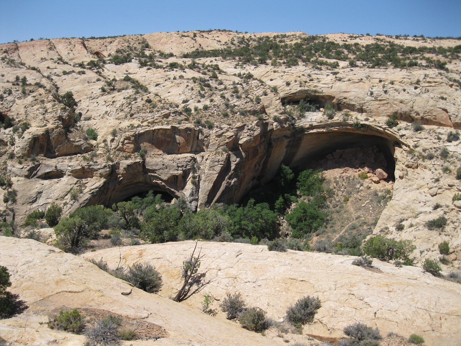
A second group of alcoves is a short distance further south. The largest alcove has a wall section visible in the shadows. There are trails visible here also. I didn't recognize this site at first, but this is the Ballroom Cave. From above, all the interior detail is invisible.

The view into a third group of alcoves is obscured by trees. I couldn’t see any structures along the edges where there is some visibility. But this is the Target Ruin site. This view shows the trail leading up to it from the main trail. The large visible alcove has some small structures and the Target site is just to the right, out of sight. The south end of Posey’s Trail should be in the area above these alcoves.

I turned around here after 2:30 hours. This trail leads toward the Upper Butler Wash Trail but I don’t know where it connects. My return hike took 2:30 hours for a total hike of 5:00 hours for about 8 miles. It was 60 F degrees at my 10:00 AM start and 78 F at the 3:00 PM finish. I carried and drank 3 liters of water.
No comments:
Post a Comment